IMMCARTAGEOTIPO
Imposta lo stile di un'immagine mappa.

Descrizione
Imposta lo stile della mappa dell'immagine mappa creata con il comando IMMCARTAGEO.
Opzioni all'interno del comando
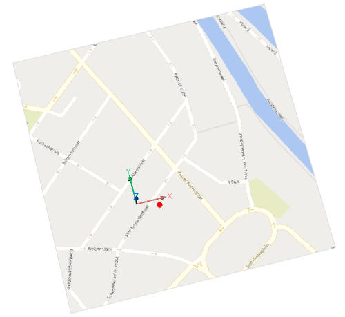
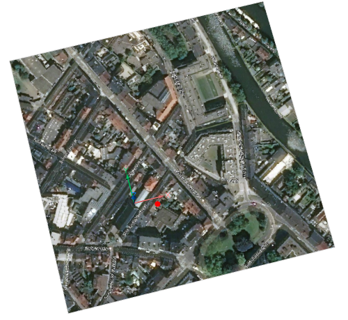
- Aerea
-
L'immagine della mappa acquisita viene visualizzata nello stile di mappa Aerea.
- Stradale
- L'immagine della mappa acquisita viene visualizzata nello stile di mappa Stradale.
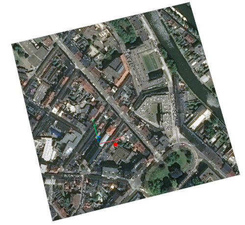
- Ibrida
-
La mappa viene visualizzata nello stile di mappa Ibrida, la quale combina lo stile mappa Aerea con Stradale.