


Manage Surface File Formats dialog box
The Manage Surface File Formats dialog box allows you to add a new point file format or to edit an existing one.
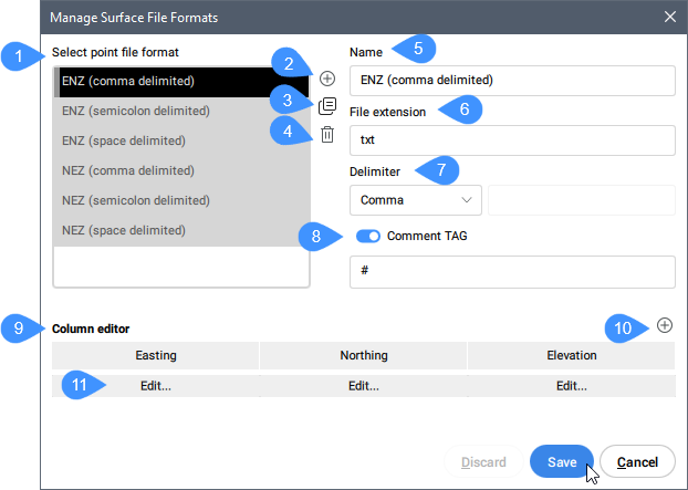
- Select point file format
- Add point file format
- Duplicate point file format
- Remove a point file format
- Name
- File extension
- Delimiter
- Comment Tag
- Column editor
- Add column
- Edit
Select point file format
Selects a point file format from the list. Some predefined point file formats are available. Their names indicate the coordinates (columns) order and the delimiter. For example, ENZ (comma delimited) is a point file format with Easting, Northing and Elevation coordinates with a comma delimiter.
Add point file format
Defines a new point file format by specifying comment tag, specifying point attributes by columns (which columns contain which point attribute in the point file).
Duplicate point file format
Creates a new point file format with the same settings as the selected one.
Remove a point file format
Removes a point file format from the list.
Name
Displays the point file format name. Click the field to edit it.
File extension
Displays the file extension. Click the field to edit it.
Delimiter
Sets a character for the column delimiter for the point file from the drop-down list.
Comment Tag
Enables or disables the comment tag.
Column editor
Displays the columns. You can change the columns order by moving it to the new location.
Add column
Opens Column Editor dialog box to add or to remove a column.
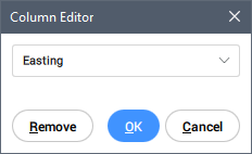
Selects a column name from the drop-down list.
You can add a <skip> column or set an existing column as <skip>, in order to create compatibility between two point format files.