MAPCONNECT command
Allows to set up a connection with a Web Map Service.

Description
Displays the Map Connect dialog box to set up a connection with a Web Map Service.
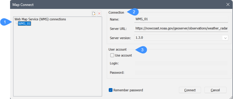
- WMS connections
- Connection
- User account
WMS connections
Displays a list of the different possible Web Map Service connections.
Connection
Allows you to create a Web Map Service (WMS) connection.
- Name
- Specifies the name for the new connection.
- Server URL
- Specifies the URL of the server you want to connect to.
- Server version
- Specifies the version of the server or else select one from the drop-down list.
User account
Allows you to log in to your account.
- Use account
- Toggles whether the login or password is used when making the connection.
- Login
- Specifies the login information.
- Password
- Specifies the password of your account.
- Remember passwords
- Check this box to keep being logged in. When is set to Off the program does not remember your passwords for greater security.
After connecting to a Web Map Server, the following dialog box is displayed:
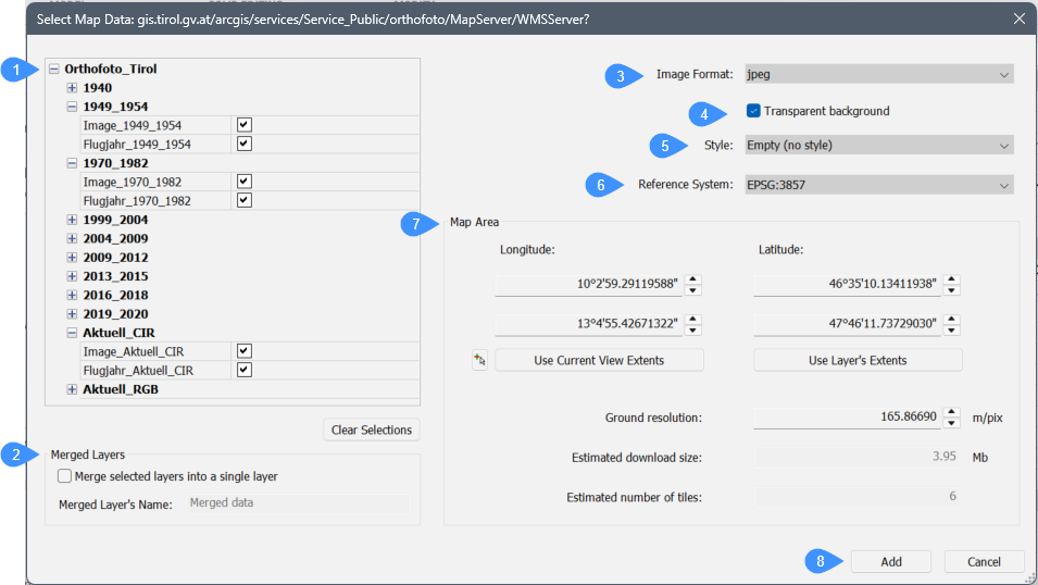 Do the following:
- Select one or more data layers.
- Specify the desired ground resolution and the preferred maximum dimensions of a tile.
- An estimate of the download size displays in the Estimated download size field.
- Press the Add button.
The program stores downloaded map tiles as regular image files in the folder in which the drawing is saved.
The definition of the supported Coordinate Reference Systems (CRS) is stored in the new geodatabase.xml file located in the folder pointed to by the ROAMABLEROOTPREFIX variable, such as C:\Users\%username%\AppData\Roaming\Bricsys\BricsCAD\V26x64\en_US\Support
The geodatabase.xml files lists cities and their WGS84 geo coordinates used by the Choose Location function of the Geographic Location dialog box.