


POINTCLOUDDEVIATION command
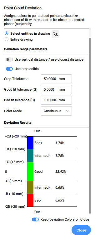
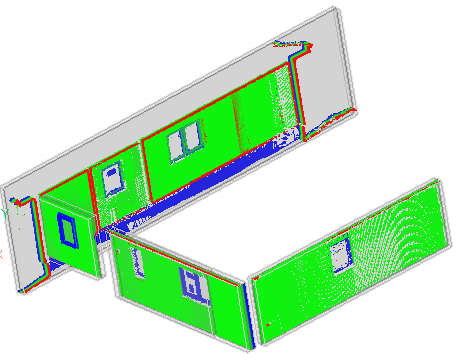
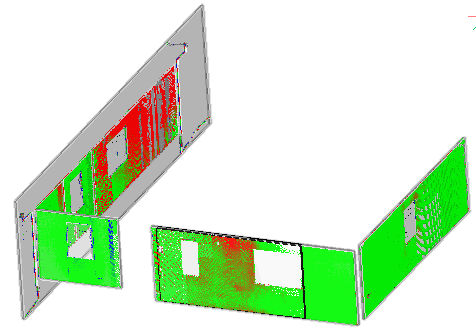
Assigns colors to point cloud points to visualize closeness of fit with respect to its closest selected planar (sub)entity. The selected entities are isolated using crops while the command panel is open.

Icon: 
Method
After selecting the planar surface or the solid from point cloud entities, the Point Cloud Deviation command panel is opened.
Options within the command and panel
- Entities
-
- Select entities in the drawing
- Selects specific geometric entities in the drawing.
- Entire drawing
- Selects all geometric entities in the drawing.
- Deviation range parameters
-
Note: Parameters previously set by the user are remembered.
- Use vertical distance / use closest distance
- Vertical distance only takes into account the difference in z-coordinate (this is relevant in civil).
- Use crop solids
- Toggles the crop of the solids.
- Crop Thickness
- Defines a thickness for a solid that is used around the geometry to compare the position of the point cloud points.
- change Input selection
- Defines a new geometry entities selection.
- Deviation Results
- Displays the point cloud distribution in percentage and colors.
-
- Keep Deviation Colors on Close
- Toggles the visualisation of the point cloud distribution in colors after closing the panel.