GEOGRAPHICLOCATION command
Allows you to assign geographic location data to a drawing file.

Icon: 
Alias: GEO, NORTH, NORTHDIR
Description
Opens the Geographic Location dialog box.
The Geographic Location dialog box allows you to set the geographic location of the drawing by selecting a CRS or by manually adding the coordinates.
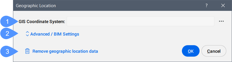
- GIS Coordinate System
- Advanced / BIM Settings
- Remove geographic location data
- GIS Coordinate System
- Reports the GIS system being used by the drawing.Note: Click the Browse button (
 ) to change the GIS Coordinate System.
- Advanced / BIM Settings
- Click to display the advanced Geographic Marker and North direction settings.
- Remove geographic location data
- Removes the geographic location data from the drawing.Note: The geographic location is automatically stored in the drawing and can be manually removed by using this option.
Advanced / BIM Settings
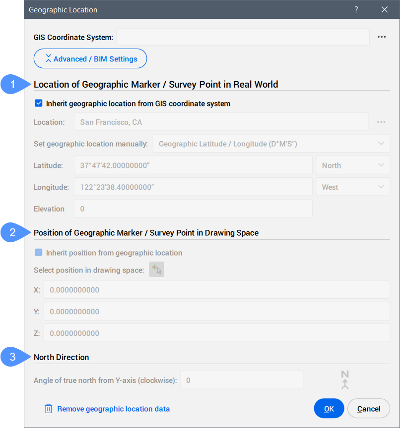
- Location of Geographic Marker / Survey Point in Real World
- Position of Geographic Marker / Survey Point in Drawing Space
- North Direction
- Location of Geographic Marker / Survey Point in Real World
-
Allows you to set the location of the geographic marker explicitly in real world coordinates by location or manually.
- Position of Geographic Marker / Survey Point in Drawing Space
-
Specifies the position of the geographic location point in the drawing. This can be inherited from the geographic location or manually set by entering X, Y, and Z values.
Note: You can also select a specific point in the workspace to set the position.
- North Direction
-
Specifies the angle of the sun from north, in the context of the world coordinate system (the angle between the True North and the Y-axis, measured clockwise).
Note: The setting is saved to the NORTHDIRECTION system variable.
About CSMAP
CSMAP is a coordinate system and map projection that allows users to access more geographic coordinates conversions and more precise geospatial analysis. Coordinate systems are a very important piece of mapping or geospatial coordinates, and are constantly updated.
You can download and install CSMAP coordinate system on demand following the next steps:
- Download the CSMAP coordinate system files:
- Unzip the archive and copy the contents into the Bricsys ProgramData or BricsCAD installation folder:
- For versions prior to V26: paste the contents into the BricsCAD installation folder. The default path is: C:\Program Files\Bricsys\BricsCAD Vxx en_US.Note: The folder name must be CoordinateSystemFiles.
- For V26 and later: paste the contents into the Bricsys Program Data folder. The default path is: C:\ProgramData\Bricsys.Note: The folder name must be CoordinateSystemFiles.VersionNumber. Example: CoordinateSystemFiles.1500.
- For versions prior to V26: paste the contents into the BricsCAD installation folder. The default path is: C:\Program Files\Bricsys\BricsCAD Vxx en_US.
- Restart BricsCAD and run the command to display the list of coordinate systems from the Geodatabase.xml file, along with the extended coordinate systems from the downloaded folders.