Geographic Location dialog box
Opens via: GEOGRAPHICLOCATION command
The Geographic Location dialog box allows you to set the geographic location of the drawing by selecting a CRS or by manually adding the coordinates.
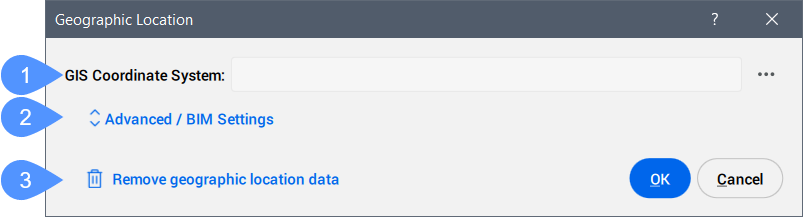
- GIS Coordinate System
- Advanced / BIM Settings
- Remove geographic location data
- GIS Coordinate System
- Reports the GIS system being used by the drawing.Note: Click the Browse button (
 ) to change the GIS Coordinate System.
- Advanced / BIM Settings
- Click to display the advanced Geographic Marker and North direction settings.
- Remove geographic location data
- Removes the geographic location data from the drawing.Note: The geographic location is automatically stored in the drawing and can be manually removed by using this option.
Advanced / BIM Settings
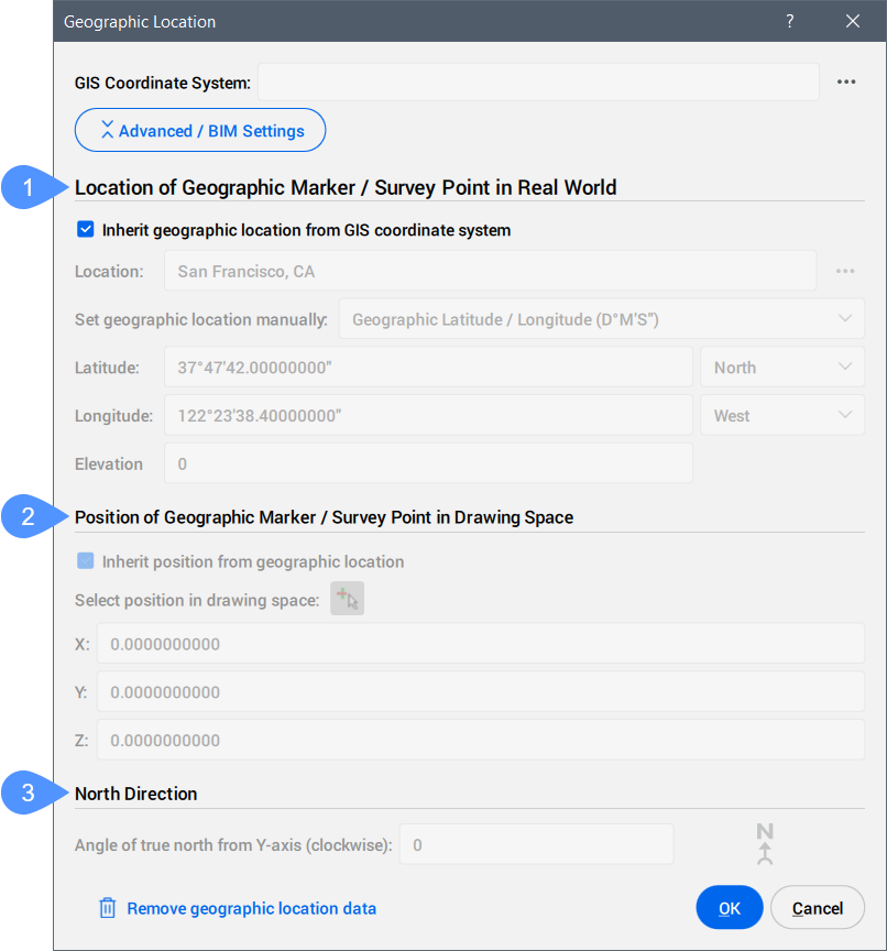
- Location of Geographic Marker / Survey Point in Real World
- Position of Geographic Marker / Survey Point in Drawing Space
- North Direction
- Location of Geographic Marker / Survey Point in Real World
-
Allows you to set the location of the geographic marker explicitly in real world coordinates by location or manually.
- Position of Geographic Marker / Survey Point in Drawing Space
-
Specifies the position of the geographic location point in the drawing. This can be inherited from the geographic location or manually set by entering X, Y, and Z values.
Note: You can also select a specific point in the workspace to set the position.
- North Direction
-
Specifies the angle of the sun from north, in the context of the world coordinate system (the angle between the True North and the Y-axis, measured clockwise).
Note: The setting is saved to the NORTHDIRECTION system variable.