Attach Point Cloud dialog box
Opens via:
- POINTCLOUDATTACH command
- Point Cloud Cache Manager dialog box
The Attach Point Cloud dialog box allows you to set the options for the attachment of a point cloud file.
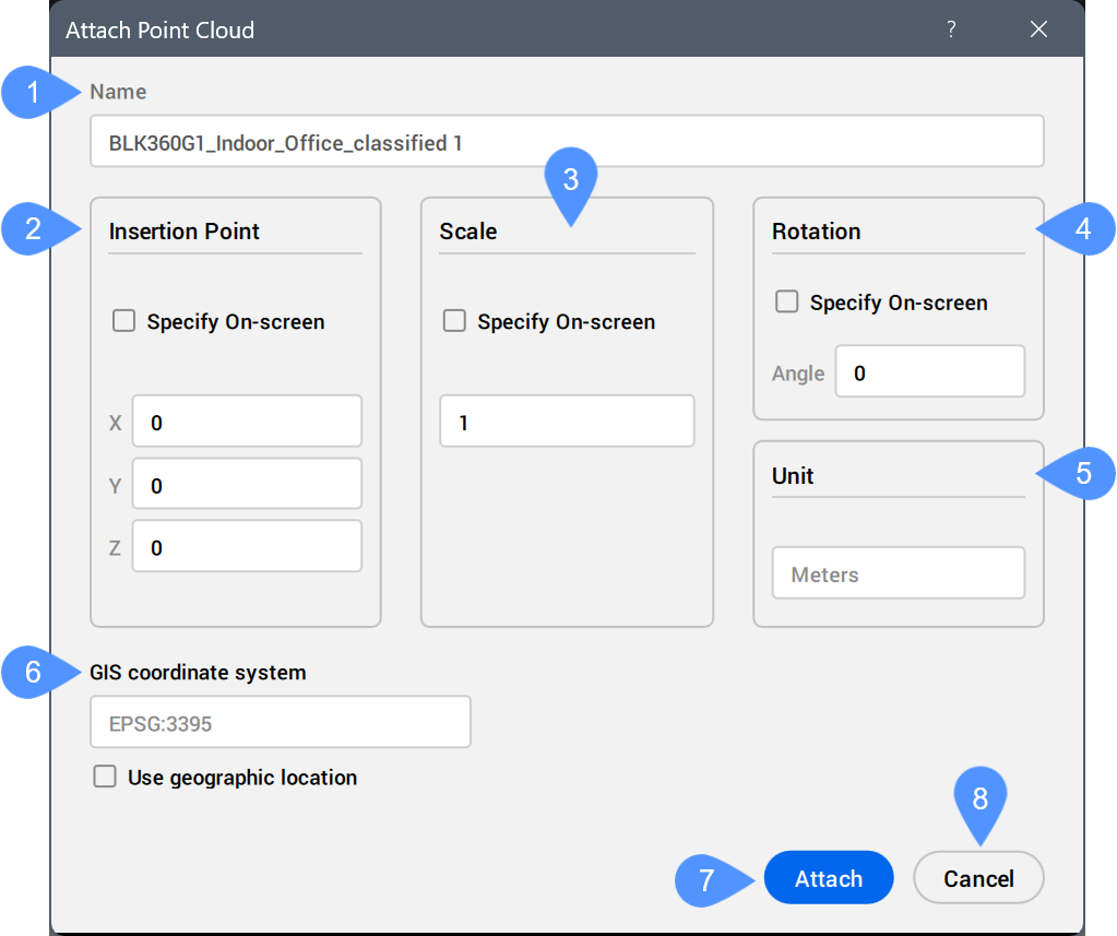
- Name
- Insertion point
- Scale
- Rotation
- Unit
- GIS coordinate system
- Attach
- Cancel
- Name
- Represents the name of the selected point cloud file that will be attached.
- Insertion point
- Defines the point where the origin of the point cloud file will be attached to.
- Scale
- Defines whether the original point cloud file is scaled or not.
- Rotation
- Defines the rotation of the original point cloud file.
- Unit
- Defines the unit of the inserted point cloud.
- GIS coordinate system
- Displays the GIS coordinate system of the cached point cloud.
Tick the Use geographic location checkbox to adjust the GIS coordinate system of the drawing to match this GIS coordinate system.
- UCS
- Displays a drop-down list with the available UCS of the point cloud.
Select one in the list to apply it to the point cloud as the active UCS.
Note:- The UCS option is available only if a point cloud that contains UCS information (LGSx files) is selected.
- You can also set the active UCS for a point cloud instance by selecting that instance in the drawing and updating the UCS property in the Properties panel.
- Attach
- Attaches the point cloud file according to the defined properties.
Note: The attached point cloud has the Locked property in the Properties panel set to Off. When it is On, the point cloud can still be selected but not deleted, moved, or edited.
- Cancel
- Cancels the attachment operation.