String Editor dialog box
Opens via:
- STRINGEDITOR command
- Civil Explorer panel > context menu of a String entity definition (Definition tab)
The String Editor dialog box allows you to edit the Civil String entities.
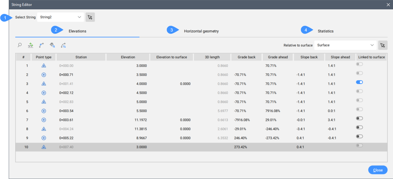
- Select String
- Elevations tab
- Horizontal geometry tab
- Statistics tab
Select String
Displays the Civil String for editing. You can select another Civil String from the drop-down list or click  to pick it from the drawing area.
Elevations tab
Lists all points properties of the Civil String for editing.
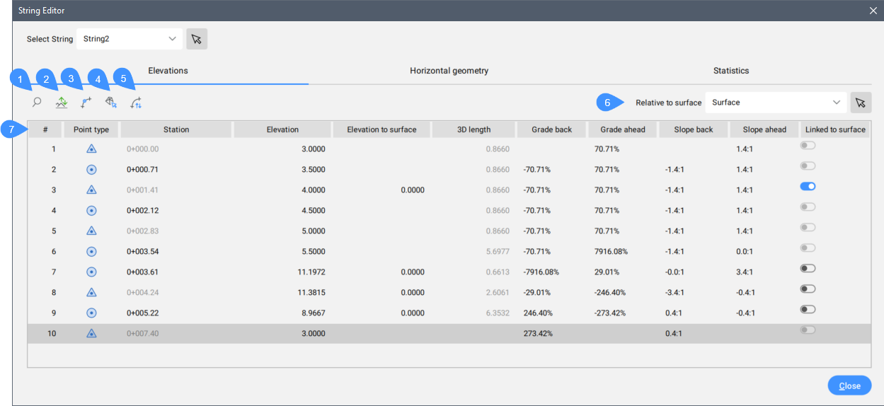
- Zoom
- Raise/Lower
- Add elevation point
- Get elevation from surface
- Reverse string
- Relative to surface
- String points properties list
- Zoom
- Zooms in the drawing to the selected Civil String.
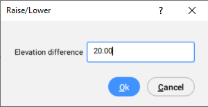
- Raise / Lower
- Opens the Raise/Lower dialog to set the elevation difference value. This value will be added to the elevations. Negative values decrease the elevation.
- Add elevation point
- Launches the STRINGADDELEVATIONPOINT command. Adds an elevation point to a Civil String entity.
- Get elevation from surface
- Opens the Elevations From Surface dialog box.
- Reverse string
- Changes the direction of the Civil String.
- Relative to surface
- Displays the selected TIN surface to which a Civil String elevations will be relative. You can select another TIN surface from the drop-down list or click to pick it from the drawing area.
- String points properties list
- Lists all String points properties.Note: Right-click a string point properties line to open a context menu with Zoom to, Pan to, Copy to clipboard, and, depending on the point type, the Delete PI (
 ) or Delete elevation point (
 ) options.
 -
- Position number
- Lists the position number of the point in the String.
- Point type
- Displays the type of point represented by different icons.
 Points intersection (PI)
 Point intersection (PI) read only
 Point intersection (PI) shared
 Elevation Point
- Station
- Displays the Station value of the point.Note: The station value for the point intersections (PI) is read-only.
- Elevation
- Displays the elevation value of the point.
- Elevation to surface
- Displays the elevation difference between the surface and String point.
- 3D length
- Displays the 3D length of the segment between the current point and the next point.
- Grade back
- Displays the grade of the current segment from its end to start.
- Grade ahead
- Defines the end elevation of the current segment in forward direction.
- Slope back
- Displays the slope of the current segment from its end to start.
- Slope ahead
- Defines the slope of the current segment in forward direction.
- Link to surface
- If ticked, the String is linked to TIN surface. Civil String elevations change dynamically with TIN surface elevations changes.
Horizontal geometry tab
Lists all segments properties of the Civil String for editing.
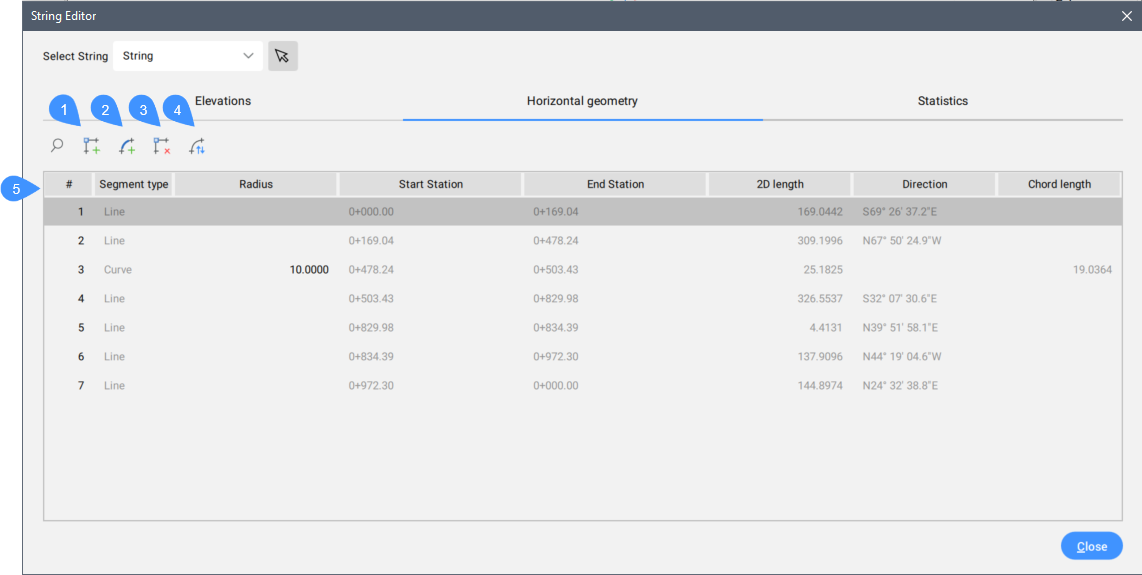
- Add PI
- Add curve
- Delete PI
- Reverse string
- String segments properties
- Add PI
- Launches the STRINGADDPI command.
- Add curve
- Launches the STRINGADDCURVE command.
- Delete PI
- Launches the STRINGDELETEPI command.
- Reverse string
- Changes the direction of the Civil String.
- String segments properties
- Lists all String segments properties.
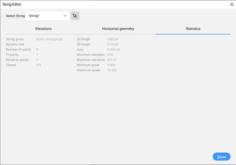
Statistics tab
Lists the general properties of the Civil String.