


MAPPACOLORINUVPUNTI
Colora la nuvola di punti.

Icona: 
Descrizione
Colora la nuvola di punti in base a un intervallo di colori. È possibile definire le opzioni tramite il pannello contesto comando Mappa Colori Nuvola di Punti nonché tramite la Barra dei comandi.
Metodo
Eseguire il comando per visualizzare il pannello contesto comando Mappa Colori Nuvola di Punti, quindi specificare i parametri della mappa colore.
Opzioni all'interno del pannello contesto comando
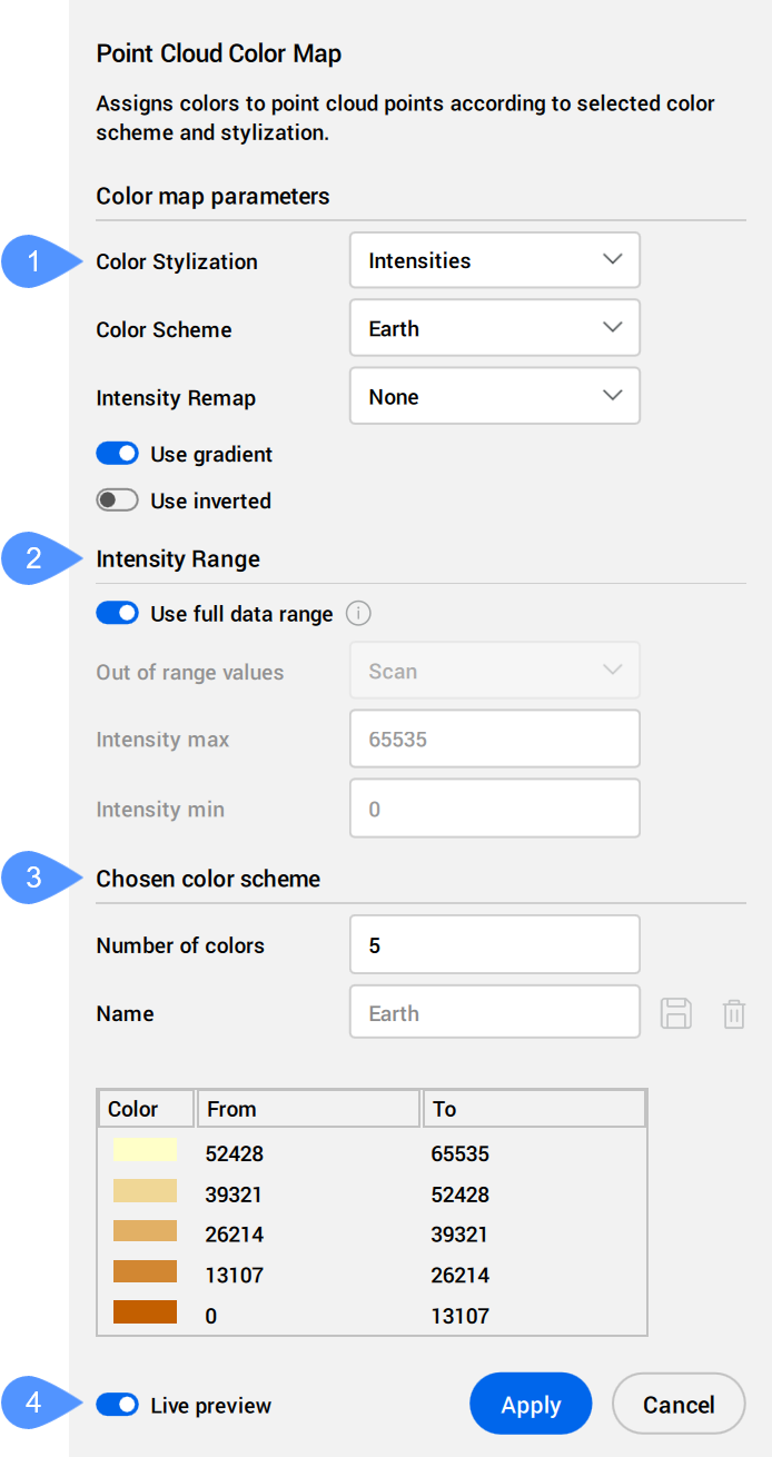
- Stilizzazione Colore
- Intervallo
- Schema colori scelto
- Anteprima live
- Stilizzazione Colore
- Specifica la stilizzazione del colore. A seconda della stilizzazione del colore scelta, sono disponibili ulteriori impostazioni diverse.
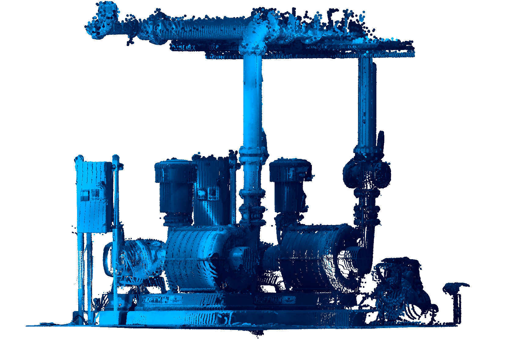
- Scansione: assegna i colori in base ai dati cromatici raccolti dalla scansione.
- Oggetto: utilizza il colore assegnato all'entità nuvola di punti nel file DWG. Questo colore può essere recuperato e modificato tramite il pannello Proprietà con la nuvola di punti selezionata.
- Elevazione: assegna i colori in base all'elevazione dei punti utilizzando una mappa colori specificata.
Gli schemi di colori predefiniti per questa stilizzazione dei colori sono Acqua, Scala di grigi, Terra, Blu, Verdi, Rossi e Spettro.
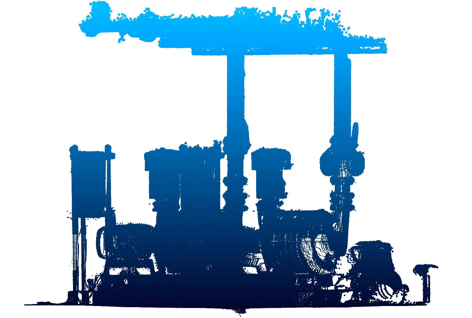
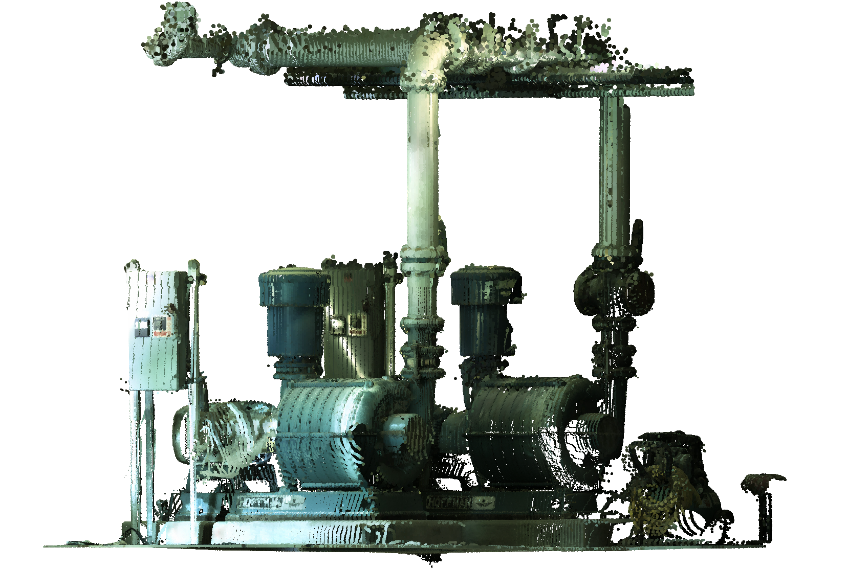
- Intensità: assegna i colori in base al loro valore di intensità secondo la mappa colori specificata.Nota: Quando il file della nuvola di punti non contiene dati di intensità, i colori vengono assegnati in base all'altezza, indipendentemente dall'opzione selezionata.
Gli schemi di colori predefiniti per questa stilizzazione dei colori sono Acqua, Scala di grigi, Terra, Blu, Verdi, Rossi e Spettro.
- Normali: assegna i colori ai punti in base alle loro normali utilizzando la mappa colori specificata.
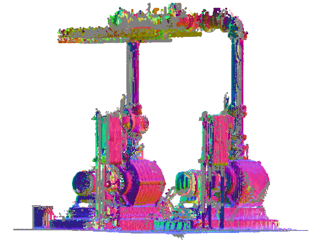
- Classificazione: assegna i colori ai punti in base alla loro classificazione utilizzando la mappa colori specificata.
Le combinazioni di colori predefinite per questa stilizzazione dei colori sono le Classificazioni Lidar e Classificazioni 3DR.
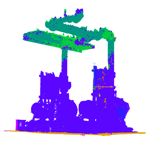 Nota: Se i punti non sono classificati, utilizzare il comando CLASSIFICANUVPUNTI prima di utilizzare il comando MAPPACOLORINUVPUNTI.
 - X-Ray: aggiunge trasparenza a livello di entità della nuvola di punti.
Consente di tracciare una nuvola di punti e creare disegni 2D basati su viste ortogonali. Vedere anche gli articoli relativi al comando PIANOSEZ e al comando ATTIVAVISTASEZIONE.
 Nota: Per Linux, forzare l'esecuzione di BricsCAD® sulla GPU così che questa funzione possa funzionare bene.
- Scansione: assegna i colori in base ai dati cromatici raccolti dalla scansione.
- Intervallo
- Determina i valori minimo e massimo per il ridimensionamento di Intensità e Elevazione utilizzati nelle mappe colore.
- Schema colori scelto
- Consente di modificare una combinazione di colori esistente o di crearne una nuova. Queste mappe vengono memorizzate nel file DWG in modo compatibile per AutoCAD®.
-
- Nome
- Specifica il nome di una nuova combinazione di colori personalizzata.
Cliccare sul pulsante Salva (
 ) per aggiungere la combinazione personalizzata all'elenco a discesa Schema colori.
Cliccare sul pulsante Rimuovi (
 ) per eliminare lo schema personalizzato selezionato.
- Anteprima live
- Quando questa opzione è selezionata, le modifiche vengono applicate automaticamente alla nuvola di punti.Nota: Quando questa opzione non è selezionata, le modifiche possono essere applicate manualmente premendo Applica.