POINTCLOUDCOLORMAP command
Colorizes the point cloud.

Icon: 
Description
Colorizes the point cloud based on a range of colors. You can define the options through the Point Cloud Color Map command context panel, as well as through the Command line.
Method
Run the command to display the Point Cloud Color Map command context panel, then specify the color map parameters.
Options within the command context panel
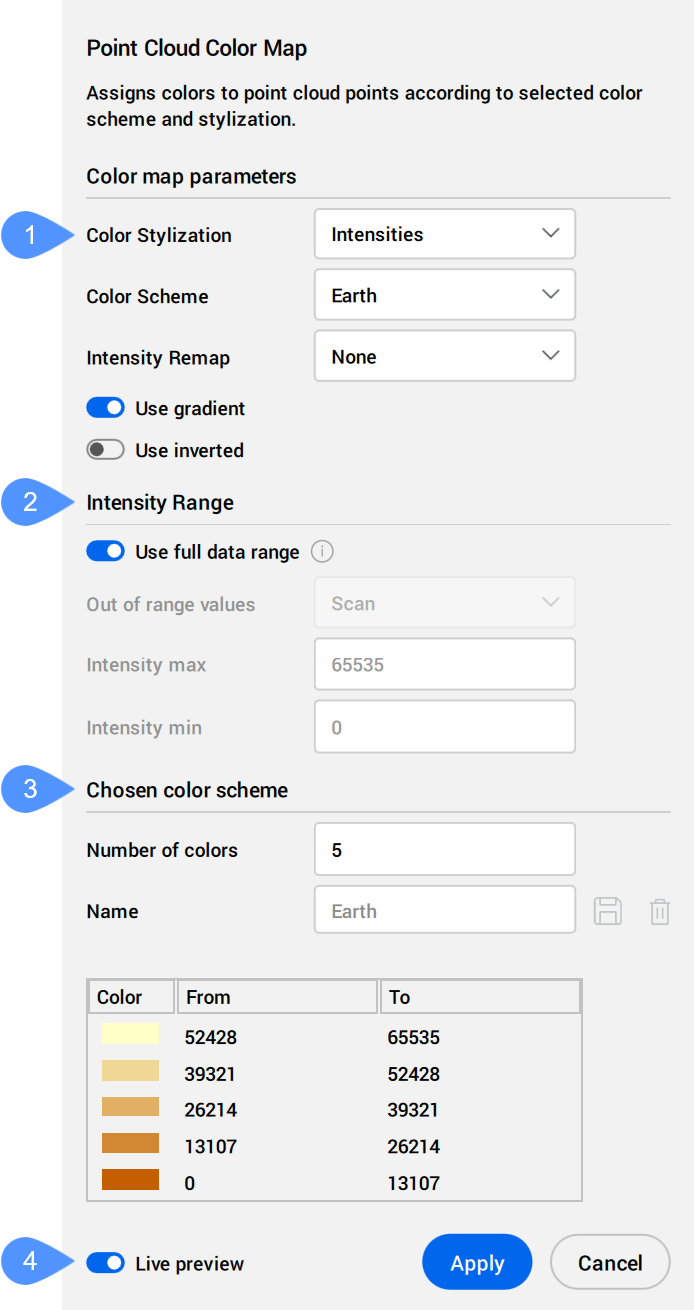
- Color Stylization
- Range
- Chosen color scheme
- Live preview
- Color Stylization
- Specifies the color stylization. Depending on the chosen color stylization, different setting are further available.
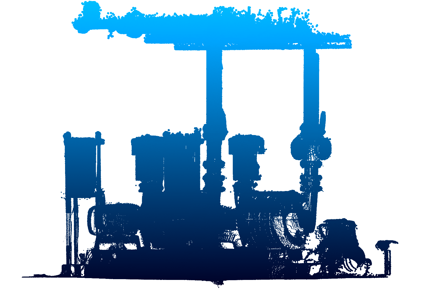
- Scan: assigns colors based on the color data collected by the scan.
- Object: uses the color assigned to the point cloud entity in the DWG file. This color can be retrieved and changed via the Properties panel with the point cloud selected.
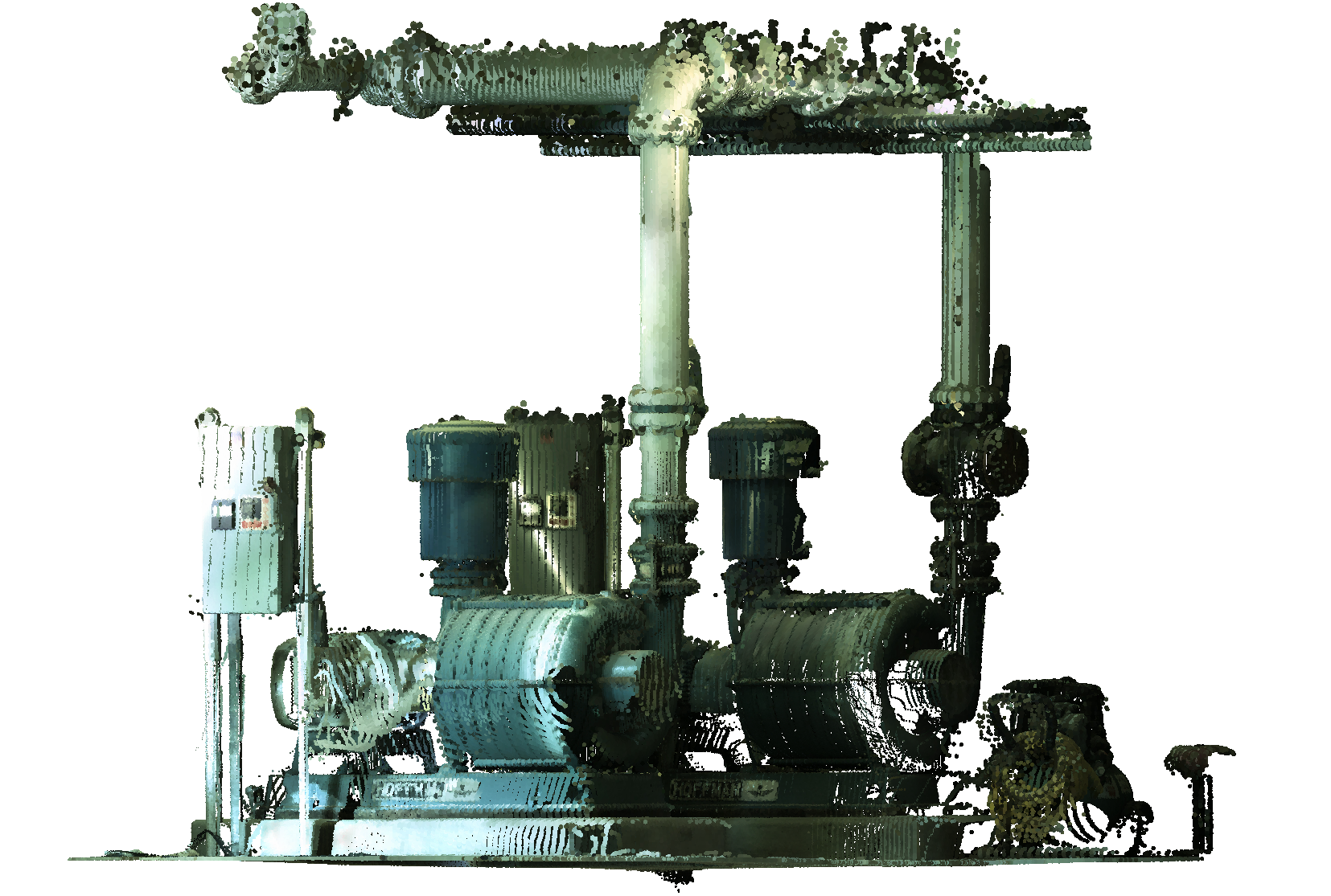
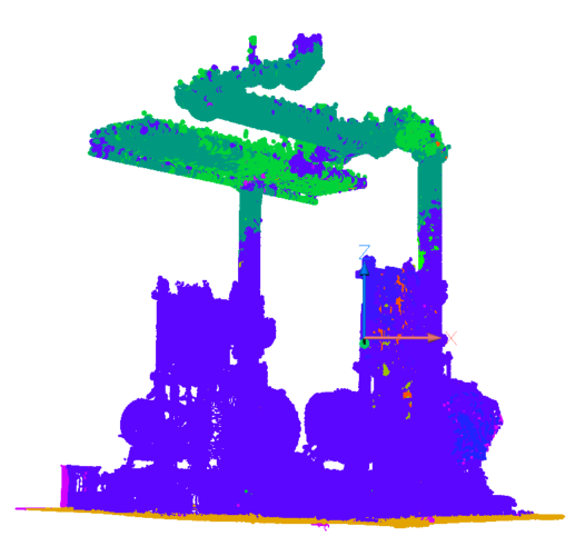
- Elevation: assigns colors based on the elevation of the points using the specified color map.
The predefined color schemes for this color stylization are Hydro, Grayscale, Earth, Blues, Greens, Reds, and Spectrum.
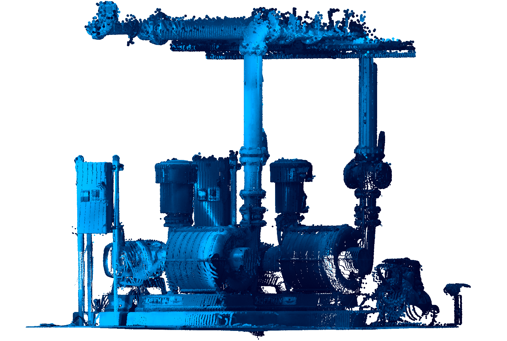
- Intensities: assigns colors according to their intensity value using the specified color map.Note: When the point cloud file does not contain any intensity data, the colors are assigned by height, regardless of the option you select.
The predefined color schemes for this color stylization are Hydro, Grayscale, Earth, Blues, Greens, Reds, and Spectrum.
- Normals: assigns colors to points based on their normals using the specified color map.
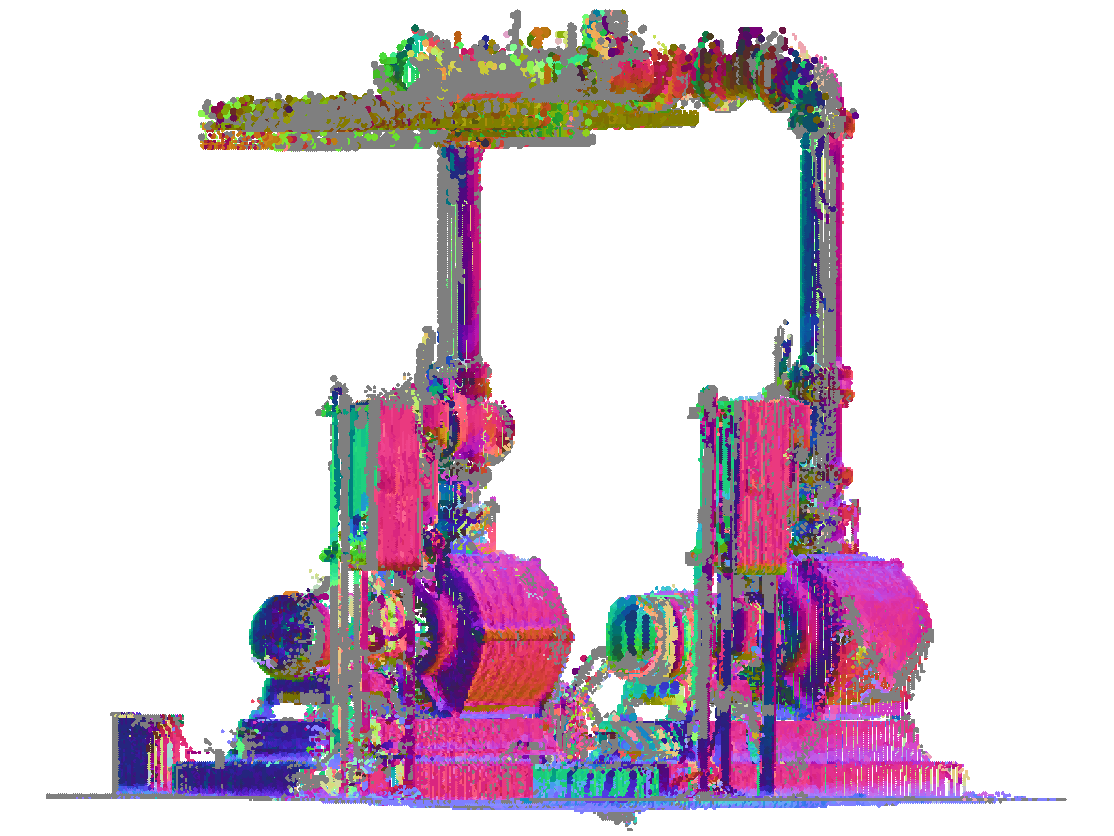
- Classification: assigns colors to points based on their classification using the specified color map.
The predefined color schemes for this color stylization are Lidar Classifications and 3DR Classifications.
 Note: If the points are not classified, use the POINTCLOUDCLASSIFY command before using the POINTCLOUDCOLORMAP command.
 - X-Ray: adds transparency at the point cloud entity level.
Allows you to trace a point cloud and create 2D drawings based on orthographic views. See also the SECTIONPLANE command and ACTIVATESECTIONVIEW command articles.
 Note: For Linux, force BricsCAD to run on the GPU so this feature can perform well.
- Scan: assigns colors based on the color data collected by the scan.
- Range
- Determines the min and max values for scaling Intensity and Elevation used in color maps.
- Chosen color scheme
- Allows you to edit an existing color scheme or to create a new one. These maps are stored in the DWG file in an AutoCAD® compatible way.
-
- Name
- Specifies the name of a new custom color scheme.
Click the Save button (
 ) to add the custom scheme to the Color Scheme drop-down list.
Click the Remove button (
 ) to delete the selected custom scheme.
- Live preview
- When checked, modifications are automatically applied to the point cloud.Note: When this option is not checked, changes can be applied manually by pressing Apply.